Google My Maps
Digitally Organizing Land and Legacy
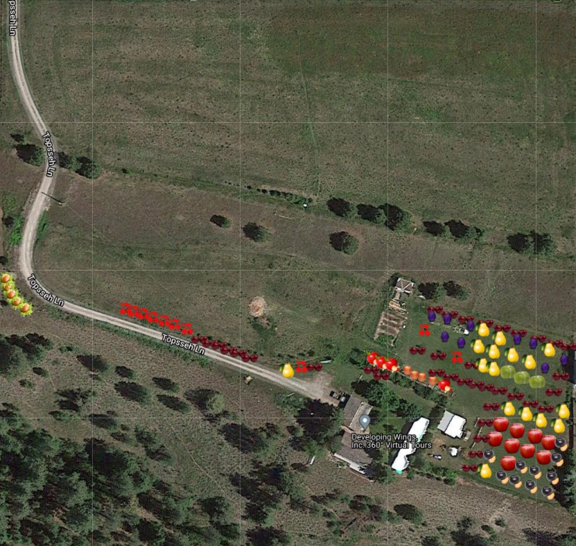
Managing the details of our 10 acres requires tracking of plantings, infrastructure, and utilities. Utilizing Google My Maps has revolutionized our approach, allowing us to digitally annotate our land with precise locations of orchards, septic and power lines, internet connections, and irrigation zones. This method not only simplifies maintenance and upgrades but also streamlines the process for potential future transactions, offering a clear, organized digital record that surpasses traditional, scribbled documentation.
DIGITALLY ORGANIZING LAND AND LEGACY
Mapping Our Haven
To use Google My Maps, start by navigating to the My Maps website and sign in with your Google account. Click on “Create a new map” to begin. You can search for specific locations or use the map directly to add points of interest. To add a marker, select the marker icon, click on your chosen location on the map, and add details or descriptions. You can also draw lines or shapes to represent areas or routes. Customize your map with layers for different categories of information, such as utilities or plantings. Remember to save your map and share it if needed. For a detailed guide, Google’s support page on My Maps is a great resource.